Tennessee Landforms -- waterfalls| WGS84 |
| 36.404150 | -84.241400 |
| 36° 24.249'N | 84° 14.484'W |
| 36° 24' 14.9"N | 84° 14' 29"W |
| 16S 747380E 4032312N |
| convert to NAD27 |
Meadow Creek Twin Falls 40'
Waypoint: CAF001 36.404150,-84.241400
County: Campbell landforms of Campbell county
Locale: RoyalBlue
popup list of
nearby landforms (mileage, bearing)
MAPS
Select one of the following maps to display this waypoint (WGS84).
GPS
Remarks:
Twin falls on Meadow Creek in TWRA WMA. off-trail
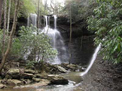
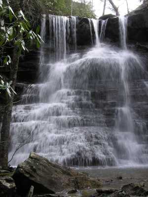
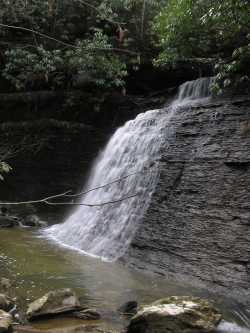
nearby is Jennings Cascade
Tennessee landforms
home
arches
waterfalls
rocks
peaks
balds
sinks
lakes
regions
county
GSMNP landforms (TN/NC)
BSF landforms (TN/KY)
or nearby
lookout towers
 ©
Tom Dunigan
©
Tom Dunigan