Tennessee Landforms -- waterfalls| WGS84 |
| 35.866450 | -82.929886 |
| 35° 51.987'N | 82° 55.793'W |
| 35° 51' 59.2"N | 82° 55' 47.6"W |
| 17S 325761E 3970856N |
| convert to NAD27 |
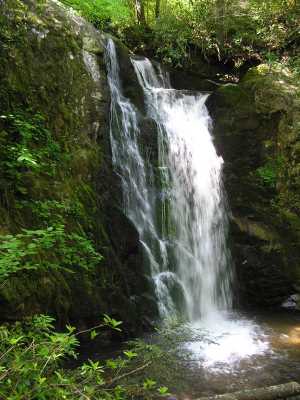
Wolf Creek Falls 30'
Waypoint: COF002 35.866450,-82.929886
County: Cocke landforms of Cocke county
Locale: Cherokee National Forest
popup list of
nearby landforms (mileage, bearing)
MAPS
Select one of the following maps to display this waypoint (WGS84).
GPS
Remarks:

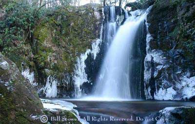 winter photo courtesy of Bill Stowell
Also see Rich Stevenson's
photos.
Tennessee landforms
home
arches
waterfalls
rocks
peaks
balds
sinks
lakes
regions
county
GSMNP landforms (TN/NC)
BSF landforms (TN/KY)
or nearby
lookout towers
 ©
Tom Dunigan
©
Tom Dunigan