Tennessee Landforms -- arches and natural bridges| WGS84 |
| 36.530380 | -84.823800 |
| 36° 31.823'N | 84° 49.428'W |
| 36° 31' 49.4"N | 84° 49' 25.7"W |
| 16S 694828E 4044981N |
| convert to NAD27 |
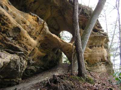
Circle Bar Arches 5x5
Waypoint: FEA029 36.530380,-84.823800
County: Fentress landforms of Fentress county
Locale: PogueCreek
NABSQNO 16S-694828-4044981
popup list of
nearby landforms (mileage, bearing)
MAPS
Select one of the following maps to display this waypoint (WGS84).
GPS
Remarks:
a circular rock window plus a rock span, off-trail, Pogue Creek
Chuck Sutherland photo
Tennessee landforms
home
arches
waterfalls
rocks
peaks
balds
sinks
lakes
regions
county
GSMNP landforms (TN/NC)
BSF landforms (TN/KY)
or nearby
lookout towers
 ©
Tom Dunigan
©
Tom Dunigan