Tennessee Landforms -- waterfalls| WGS84 |
| 35.433100 | -84.150500 |
| 35° 25.986'N | 84° 9.03'W |
| 35° 25' 59.2"N | 84° 9' 1.8"W |
| 16S 758679E 3924805N |
| convert to NAD27 |
Ballplay Falls 45'
Waypoint: MOF021 35.433100,-84.150500
County: Monroe landforms of Monroe county
Locale: Cherokee National Forest
popup list of
nearby landforms (mileage, bearing)
MAPS
Select one of the following maps to display this waypoint (WGS84).
GPS
Remarks:
Reference: Jack waters
manway
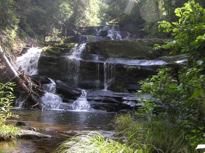 both falls
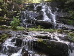 upper half
Tennessee landforms
home
arches
waterfalls
rocks
peaks
balds
sinks
lakes
regions
county
GSMNP landforms (TN/NC)
BSF landforms (TN/KY)
or nearby
lookout towers
 ©
Tom Dunigan
©
Tom Dunigan