| WGS84 | |
| 36.579434 | -84.665459 |
| 36° 34.766'N | 84° 39.928'W |
| 36° 34' 46"N | 84° 39' 55.7"W |
| 16S 708874E 4050756N | |
| convert to NAD27 | |
MAPS
Select one of the following maps to display this waypoint (WGS84).
GPS
Remarks:
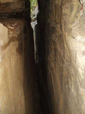
The cap rock has broken into a big chimney, leaving only a shoulder-wide slot for you to scramble down. There are numerous free standing butte's along No Business Creek to the north. A small arch at the base of the crack.