| WGS84 | |
| 36.151900 | -82.327200 |
| 36° 9.114'N | 82° 19.632'W |
| 36° 9' 6.8"N | 82° 19' 37.9"W |
| 17S 380609E 4001612N | |
| convert to NAD27 | |
MAPS
Select one of the following maps to display this waypoint (WGS84).
GPS
Remarks:
Reference: Bill Stowell, upper falls Marty Silver and Mark Oleg
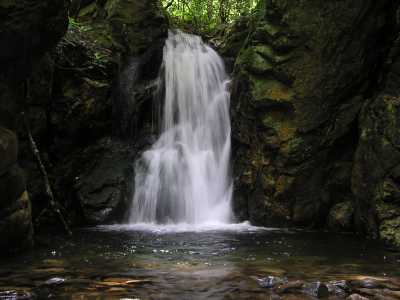
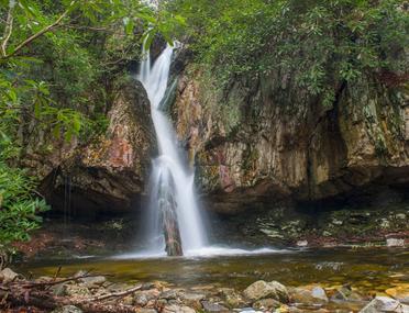
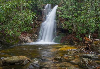
The waypoint is for the lower falls. About 3/4 mile further up the creek are 3 more falls.
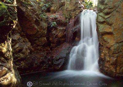
 Marty's photo of upper falls, 30' at
36.14482,-82.3211 at about 3000' contour
Marty's photo of upper falls, 30' at
36.14482,-82.3211 at about 3000' contour
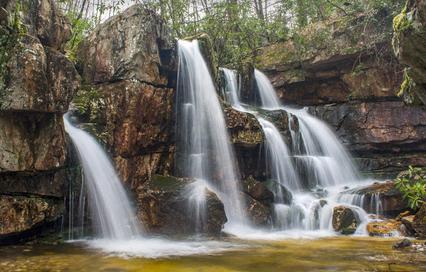
In 2018, Mark Oleg writes: "Only one-tenth of a mile above Upper Dick Creek Falls is a stunning 60-foot waterfall that people call Upper Upper Dick Creek Falls. Between Lower Dick Creek Falls and Upper Dick Creek Falls is a path (albeit faint). The path gets even fainter between Upper Dick Creek Falls and Upper Upper Dick Creek Falls, but I still wouldn't call the hike a bushwhack. Upper Upper Dick Creek Falls is at the coordinates N36° 08.662' W82° 19.175'.
Right at the top of Upper Upper Dick Creek Falls is another waterfall that people call Upper Upper Upper Dick Creek Falls. These are the only names that I have seen for these waterfalls. Upper Upper Upper Dick Creek Falls is a 20-foot vertical drop. You have to scramble steeply up through two cliff notches on the River Right (north) side of Upper Upper Dick Creek Falls to get to Upper Upper Upper. Upper Upper Upper Dick Creek Falls is at the coordinates N36° 08.672' W82° 19.142'."
Mark Oleg of www.hikingtheappalachians.com photos:
 Upper Dick Creek Falls
at
36.14482,-82.3211
Upper Dick Creek Falls
at
36.14482,-82.3211
 Upper Upper Dick Creek Falls, 60',
at
36.144367,-82.319583
Upper Upper Dick Creek Falls, 60',
at
36.144367,-82.319583
 Upper Upper Upper Dick Creek Falls, 20',
at
36.144533,-82.319033
Upper Upper Upper Dick Creek Falls, 20',
at
36.144533,-82.319033
Mark's Dick Creek trip report