Tennessee Landforms -- waterfalls| WGS84 |
| 36.116700 | -82.389900 |
| 36° 7.002'N | 82° 23.394'W |
| 36° 7' 0.1"N | 82° 23' 23.6"W |
| 17S 374913E 3997787N |
| convert to NAD27 |
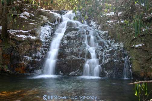
Martin Creek Falls 20'
Waypoint: UCF010 36.116700,-82.389900
County: Unicoi landforms of Unicoi county
Locale: Cherokee National Forest
popup list of
nearby landforms (mileage, bearing)
MAPS
Select one of the following maps to display this waypoint (WGS84).
GPS
Remarks:
Reference: Bill/Craig.
Photo courtesy of Bill Stowell.
Tennessee landforms
home
arches
waterfalls
rocks
peaks
balds
sinks
lakes
regions
county
GSMNP landforms (TN/NC)
BSF landforms (TN/KY)
or nearby
lookout towers
 ©
Tom Dunigan
©
Tom Dunigan