Tennessee Landforms -- waterfalls| WGS84 |
| 36.134360 | -82.536720 |
| 36° 8.062'N | 82° 32.203'W |
| 36° 8' 3.7"N | 82° 32' 12.2"W |
| 17S 361729E 3999945N |
| convert to NAD27 |
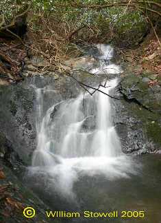
Hell Hollow Falls (2) 20'
Waypoint: UCF024 36.134360,-82.536720
County: Unicoi landforms of Unicoi county
Locale: Cherokee National Forest
popup list of
nearby landforms (mileage, bearing)
MAPS
Select one of the following maps to display this waypoint (WGS84).
GPS
Remarks:
Reference: Bill & Craig, photos courtesy of Bill Stowell
off-trail in Clarks Creek
twin falls
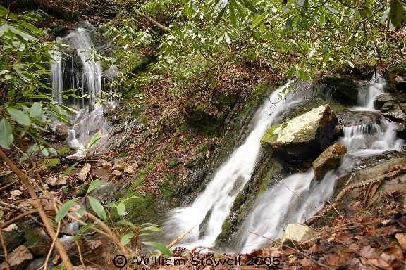
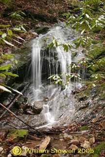
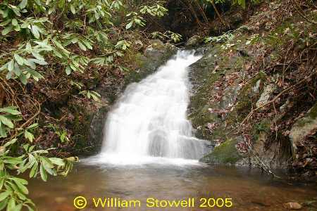
Another 20' falls further upstream at
36.13452 -82.53694
Tennessee landforms
home
arches
waterfalls
rocks
peaks
balds
sinks
lakes
regions
county
GSMNP landforms (TN/NC)
BSF landforms (TN/KY)
or nearby
lookout towers
 ©
Tom Dunigan
©
Tom Dunigan