Each box is 1 km x 1 km.
|
|
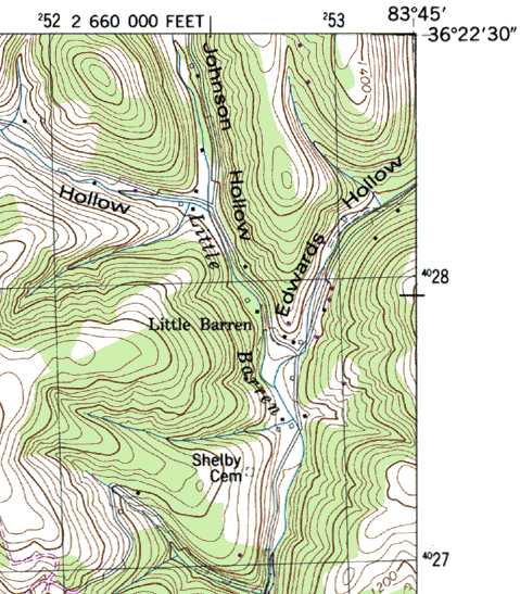
Draw in the UTM grid lines on your USGS topo map.
Each box is 1 km x 1 km. |
|
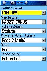
| Set up your GPS to use NAD27 datum and UTM coordinates. |
Though you may not have cell-coverage in the backcountry, there are mobile apps where you can preload topo maps and still use the GPS on the cell phone. On my iPhone I use iHikeGPS
Also see MGRS Military Grid Reference System.
 Tennessee landforms