Distance: 8 miles roundtrip
Difficulty: strenuous
Maps:
(trailhead)
maps
and Google directions
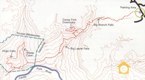
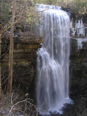
This rugged hike has creek crossings, vistas from the rim, caves, disappearing creeks, and several watefalls -- Big Laurel Falls, Big Branch Falls, and Sheep Cave Falls. The creek feeding Virgin Falls comes out of a cave, travels about 60' before plunging 110' and disappearing again into a sinkhole. Also see TN state natural area info and map (pdf).
Originally, there were two sets of steps to take you up and back down the overlook off the main-trail. As of 2008, there is just one set of steps.
GPS track google map of Virgin Falls hike -- 1100' cumulative climb (plus 150' if you climb up to the bluff overlook). Topo! GPS track