Harding Icefield and Exit Glacier
Kenai Fjords National Park
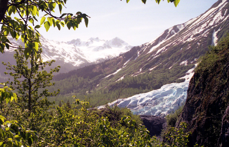
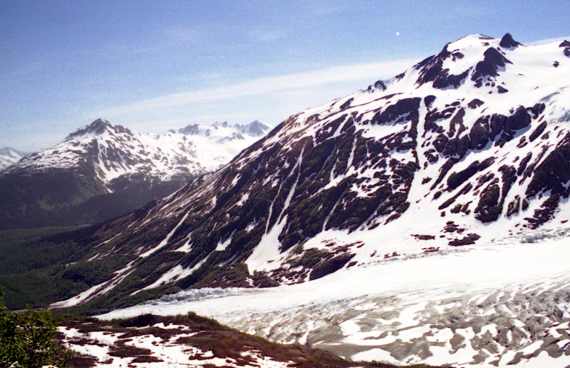
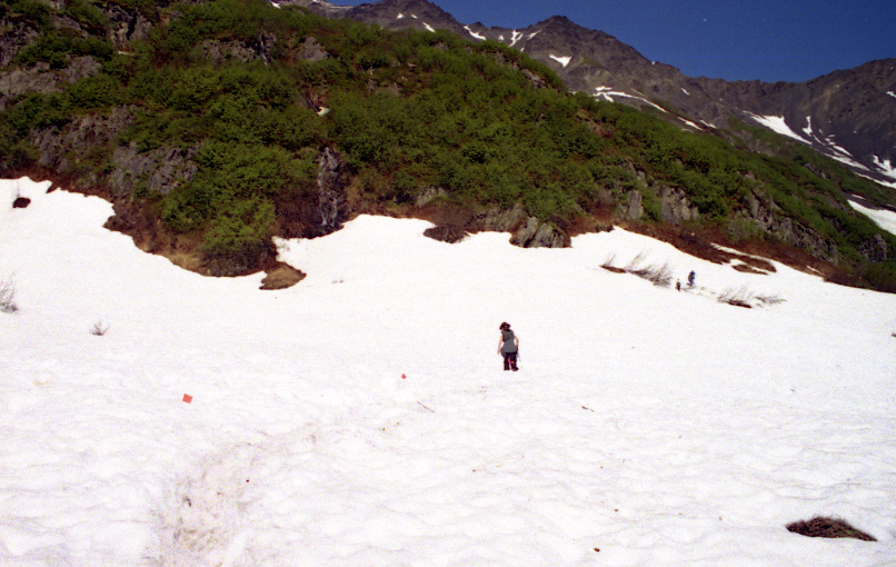
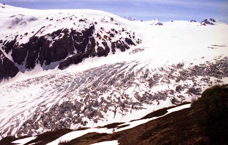
Kenai Fjords National Park is pretty much an immense pack of ice, with Harding Icefield sitting on top of the mountains on Kenai Peninsula. Many glaciers come off from the Harding Icefield. Exit glacier is one of the most accessible glaciers to human in the whole world. One can drive to the foot of it. Below are four pictures taken from long distance away to real close-up. From far away, the ice-rivers coming out looked like tiny belts. However, getting closer to it, it turned out to be really wide. (Notice how small people show up on the picture second to the left) There is an easy trail that goes up into the glacier. On top there, the bluish glacier ice shined with a mysterious bluish touch.


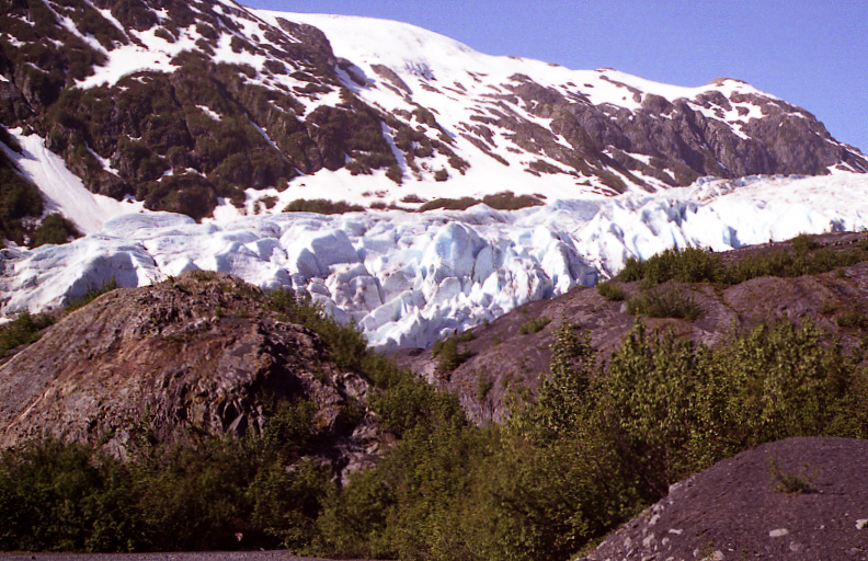
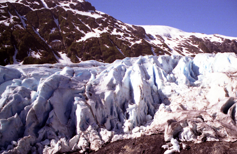
Exit Glacier


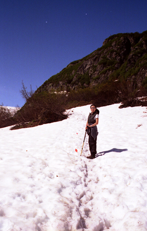
Wife with Exit Glacier
The Harding Icefield trail has its trailhead just beside the Exit Glacier trail. It’s about 2.5 miles till the overlook point and 3.85 mile to the very end, where the grand, serene icefield just lays in front of its visitors. The total elevation gain is roughly 3000 feet (~800 meters?). The beginning segment of the trail was a little steep, but quite fun. We were able to appreciate the Exit Glacier, which appeared below us now and then, and the heavy snow packs over ice rivers and ice rivers themselves.


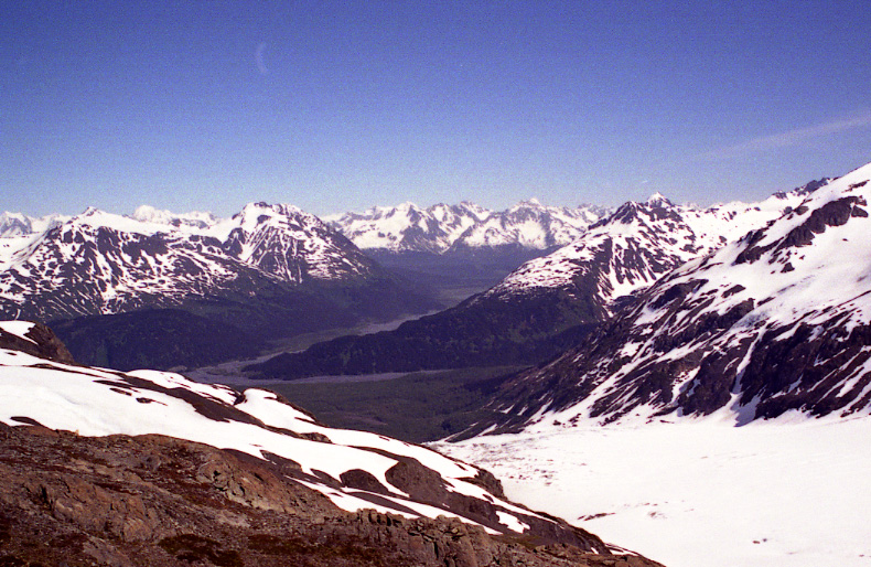
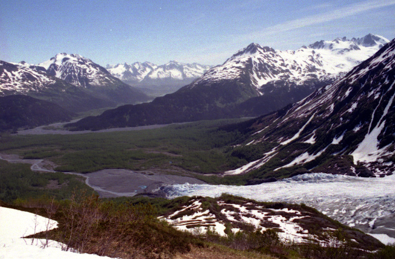
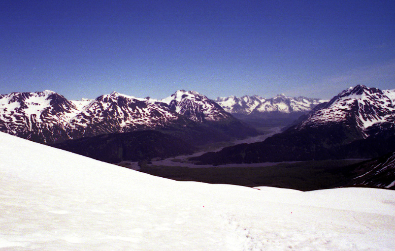
As we climbed above tree line, we shot a lot of awesome views of the valleys opposite to the valley where the Exit Glacier (on the lower-right corner in the pictures below) was coming off.
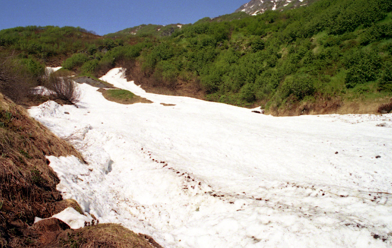
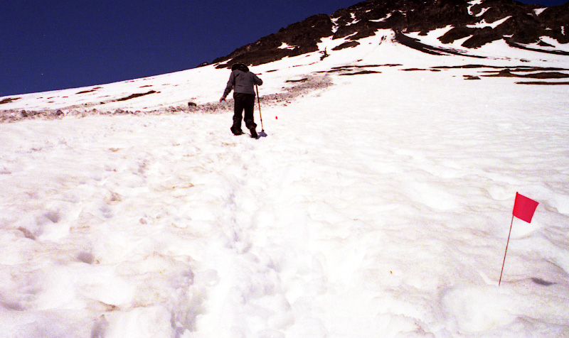
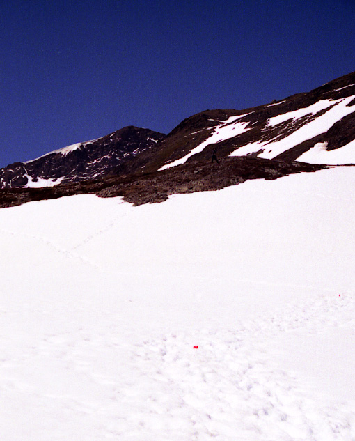
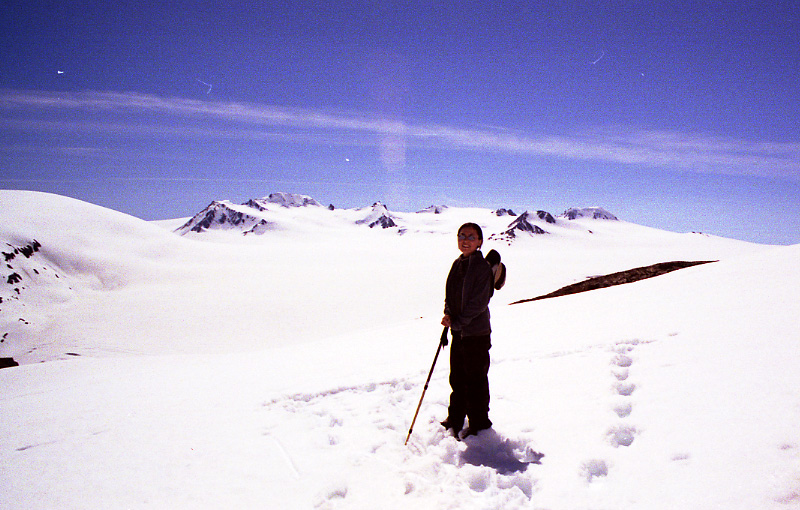
While enjoying the nice views and sunshine, the hike became very difficult, because we started to walk on the snowfield all the time. There was no trail of any kind, only snow. We kept following the little red flags, and hoped we won’t stump into an ice river underneath. It was extremely slippery. Hiking was tough.

It kept going and going. I prepared for this hike by running 3k’s back home for 3 months. However, that did not seem to be enough. The hiking pack on my back felt heavier each time my foot slipped. Occasionally, half of my leg would sink into the deep snow. But, we were getting closer and closer to the overlook point. It was pretty and interesting when you look at the breakage on the glacier tongue. Later we were told that it always happens when a glacier turns in direction.
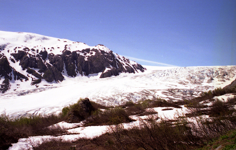


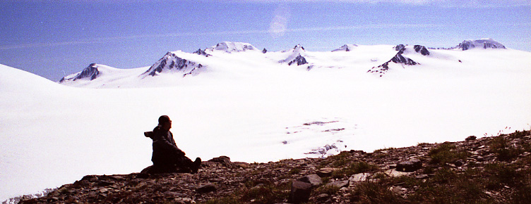
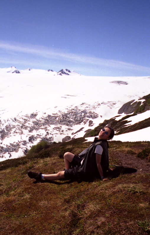
Overlooking the Exit Glacier

Snow and the mountains
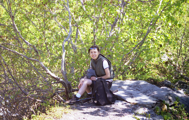
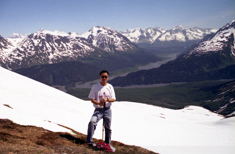
After about 3 hours, we reached the overlook point. Very amazing views again, this time with my honey in the viewfinder too.

Then came the question. It seemed quite obvious that we were not at the trail end, but we did not know how far more there was to go. At the visitor’s center, we were also told that there had been an avalanche two days ago beyond the 2.5-mile mark on the trail. The problem was we did not know how far we had climbed. Below (left) is a picture I took of the trail beyond the overlook point. Those people resting on the little piece of tundra did not go further, they turned and headed back. Actually, another serious problem we had was “water”. We almost ran out of water, with about a quarter of a 1-liter bottle left for the two of us. Well, the decision by the boss was to forge ahead. The red lines were marked to show the exact path that we went. After spending half an hour to fight to the end of the red line, I looked back and actually found out “we just passed the avalanche site! ” (below-right). The red dots in the left pictures show the spots of the avalanche.
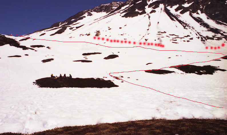

That half-an-hour hike was very difficult and a little treacherous too, as documented below.

The problem was after reaching the end of the red line, we saw no end of the trail in sight. It went over another higher ridge. After slipping, stumbling, finally out of water, climbing over a ridge, another ridge,..., we reached the end. Magnificent!!


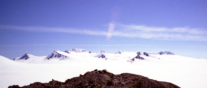
It was quite a pity that I did not see the glare in my lens when I shot the above pictures of the Harding Icefield. It was just too sunny for me to take off my sunglass. Just couldn’t bear the blinding strong lights through the viewfinder on my camera.